
Skip to content
Swaidan Engineering & Consultancy

Company Profile & Institutional Capabilities

In the print dialog choose “Save as PDF”, A4 paper, and turn off “Headers and footers” for the official copy.

Swaidan Engineering & Consultancy

Edition 2026

Since 1999

Company Profile & Institutional Capabilities

Swaidan Engineering & Consultancy

شركة سويدان للإستشارات والدراسات الهندسية

Surveying, cadastral demarcation, urban master planning, infrastructure design and spatial data systems, delivered as licence-ready drawings and geodetically referenced datasets.

Official Registration & Classification

Commercial Register – Saida
16236
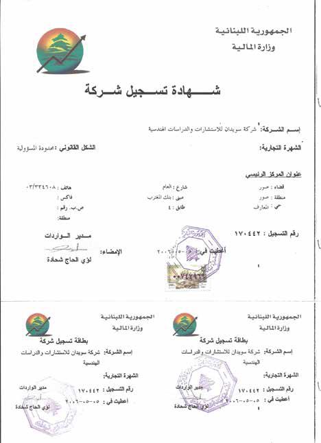
Ministry of Finance – Revenue
170442
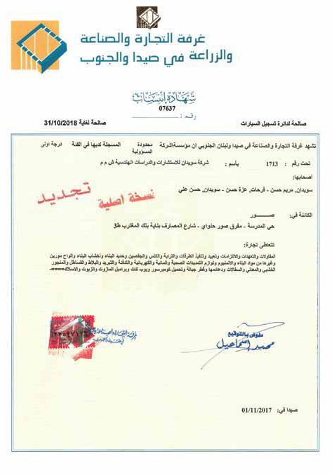
Chamber of Commerce – Saida & South
First Class · 1713
Council for Development & Reconstruction
First-Class Consultant

Main Road, Batoulay – Tyre, South Lebanonwww.swaidan-co.com

01Foreword

27 years of engineering work

Swaidan Engineering & Consultancy

Since the company’s inception on January 4, 1999, we have adhered to a single principle: that every study must be grounded in a precise assessment of the land prior to any decision-making. Over the course of more than twenty-seven years, Swaidan has evolved from a land surveying and subdivision office into a First-Class engineering consultancy—accredited by the Council for Development and Reconstruction—serving municipalities, government bodies, developers, and investors. We present this profile to showcase the expertise and resources we have cultivated: a network of permanent reference stations covering Lebanese territory, a fleet of satellite positioning equipment, a team of specialized consultants and engineers, and advanced capabilities in Geographic Information Systems (GIS) and geospatial artificial intelligence. We look forward to partnering with you to transform land into viable projects, with the precision and sense of responsibility for which we are known.

Eng. Hassan Swaidan

General Manager & Founder

Mrs. Azza Farhat

Owner

02Institutional Figures

Figures, Scope & the Spatial Land Bank

Swaidan Engineering & Consultancy
+27
years of experience since 1999
+150
completed projects
+30
engineers & consultants
2
public & private sectors

Scope of Practice

  1. 01Civil, urban and rural planning, and master-plan design
  2. 02Applied geodesy, precision GNSS positioning and topographic survey
  3. 03Roads, bridges and integrated infrastructure networks
  4. 04Real-estate development, investment and subdivision
  5. 05Engineering project management, site supervision and quality control

Automated Cadastral & GIS Land Bank

A computerised information network covering the whole of Lebanon, bringing survey, cadastral and zoning data into a single base.

  • Survey maps
  • Cadastral maps
  • Master plans
  • Land-ownership returns

03Advanced Capabilities

Technical Disciplines & GeoAI

Geographic information systems combined with generative AI and deep-learning models in a single analytical stack.

Swaidan Engineering & Consultancy
  • 01

    Urban Footprint & AI Density Mapping

    Extracting building footprints and roads from imagery and computing urban and population density.

  • 02

    Deep Learning Solar PV Detection

    Deep-learning models (ResNet) that locate and inventory renewable-energy rooftops.

  • 03

    NDVI & Vegetation Health Analysis

    Environmental NDVI & Vegetation Health

    Monitoring green cover and drought stress through NDVI and VARI indices.

  • 04

    Satellite Land-Use Classification

    Separating agricultural, urban, forest and water land cover from satellite imagery.

  • 05

    Digital Elevation Models & Hydrology

    Producing DEMs and analysing slope lines and flood-flow paths.

  • 06

    Interactive Strategic Dashboards

    Live platforms for project tracking, asset management and key indicators.

  • 07

    Landslide & Rockfall Susceptibility

    Modelling exposure to landslides and rockfall to inform safe planning.

  • 08

    Multi-hazard Disaster Risk Assessment

    Flood, wildfire and landslide risk modelled in one integrated assessment.

  • 09

    Groundwater & Soil Moisture Modelling

    Groundwater Aquifer & Soil Moisture Modelling

    Modelling groundwater movement and soil moisture for water-resource management.

  • 10

    Transport Accessibility & Network Optimisation

    Analysing access to services and optimising road and transport networks.

  • 11

    Air Quality Dispersion & Pollution Monitoring

    Modelling the dispersion of air and environmental pollutants.

  • 12

    Precision Agriculture & Drone Photogrammetry

    Drone imagery combined with intelligent irrigation and fertilisation analysis.

04Geodetic Infrastructure

The CORS / VRS Permanent Geodetic Network

In partnership with Geomasters Middle East

Swaidan Engineering & Consultancy

Swaidan established the first and largest network of Continuously Operating Reference Stations (CORS) covering the whole of Lebanon.

It operates as a Virtual Reference Station (VRS) service over the internet and the local cellular (GSM) network, giving field GNSS rovers high real-time accuracy.

Real-time (RTK) accuracy better than 2 cm, horizontal and vertical

Permanent reference stationsNetwork server · VRSField RTK rover
  • Coverage of the whole of Lebanon
  • Coverage diameter above 100 km per station
  • Corrections streamed over internet and GSM
  • Tied into the international triangulation frameworks

05Equipment

الأجهزة الهندسية والتجهيزات والبرمجيات

Company-owned equipment, operated and maintained in-house.

Swaidan Engineering & Consultancy

أجهزة هندسية GNSS / RTK

ModelManufacturerQty
Spectra Precision SP80Spectra (Trimble)4
Sokkia GSR 2700 ISXSokkia5
Sokkia GSR 2600Sokkia1
Hi-Target V90 Plus GNSS RTKHi-Target7
Hi-Target V60 GNSS RTKHi-Target2
Hi-Target V100 CompactHi-Target1
Total — 20 GNSS stations20

Total Stations & Levels

  • Sokkia SET 3030Total station2
  • Nikon Nivo 2.CTotal station1
  • Digital precision levelsLeica / SokkiaHigh-precision geodetic levelling—

Survey Drones (UAV)

  • Professional survey drones (UAV)Aerial topographic survey, 3D models and orthophoto plans—

Servers & Workstations

  • HP ProLiant ML350 G6Central database and network servers2
  • Dell OptiPlex 960Workstations for spatial processing and modelling (7+)7

Plotters & Printers

  • HP DesignJet T2500 eMultifunctionMultifunction engineering plotter2
  • HP DesignJet T770Large-format plotter1
  • HP LaserJet 700 Color MFPEnterprise colour printers3

Engineering & Applied Software

GIS & Remote Sensing

  • ArcGIS Pro 3.5+
  • ArcMap 10.8
  • QGIS
  • Bentley MicroStation V8i
  • SASPlanet
  • Google Earth Pro

BIM & CAD

  • AutoCAD 2025
  • Civil 3D 2025
  • Revit
  • Land Desktop

Structural & Infrastructure Analysis

  • ETABS
  • Robot Structural Analysis
  • SewerCAD
  • WaterCAD
  • RAM Concept
  • STAAD.Pro

Project Management & Design

  • Oracle Primavera P6
  • 3ds Max
  • Blender
  • Adobe Creative Cloud

06Flagship Projects

Selected Flagship Projects

Swaidan Engineering & Consultancy

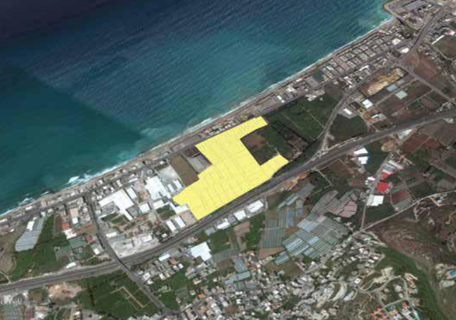
3,529,502 m²

Medyar

Dalhamiyeh / Debbiyeh

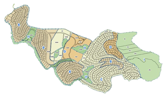
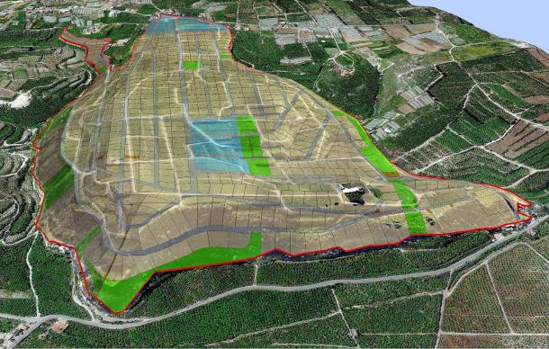
One of the largest integrated urban plans in Lebanon: 69 parent plots subdivided into lots from 1,200 m².

  • 40 km of roads, 10–22 m wide
  • 40% green space and reserves
  • 7 development zones

Studies delivered

  • Drinking-water networks and pumping stations
  • Sewerage, collection and treatment stations
  • Underground power, telecoms and fibre
  • Fire-fighting and landscape irrigation
Project page on the website

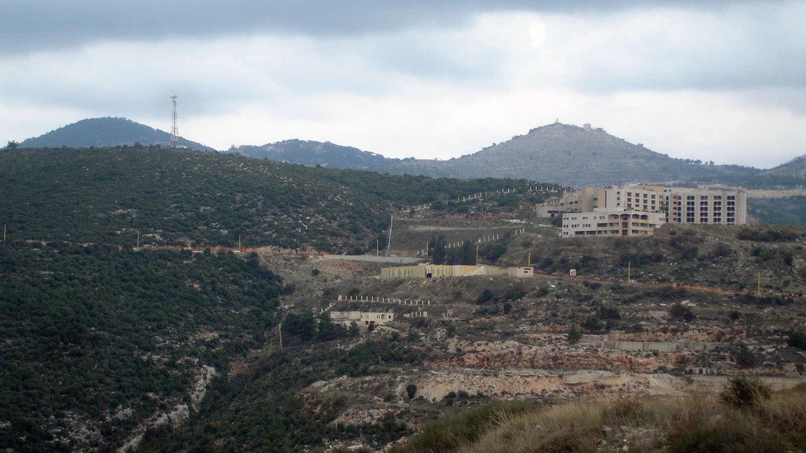
1,000,000 m²

Litani Hills

Linking the Tyre, Nabatieh and Saida districts

A subdivision plan with lots from 1,000 m², built on an aerial drone topographic survey.

  • 20 km of roads, 10–16 m wide
  • 25% green space

Studies delivered

  • Aerial drone topographic survey
  • Lot subdivision
  • Infrastructure network design
Project page on the website

141,640 m²

Ghazieh Industrial Park

Between the old and new Saida–Tyre highways

A master plan for a modern industrial and commercial zone.

Studies delivered

  • Industrial and commercial master plan
  • Water, sewerage and fire-fighting networks
  • Road network for trucks and heavy loads
Project page on the website

2,537,373 m²

Kfarfalous Land Reclamation

Kfarfalous – Jezzine

An agricultural reclamation project across 15 parent plots.

  • 25 km of agricultural and mountain roads
  • 7 development zones

Studies delivered

  • Reclamation and agricultural terracing
  • Permanent geodetic control grid
  • Irrigation and stormwater drainage

07People

Leadership, Consultants & Staff

Four divisions; each member's full CV is published on the website.

Swaidan Engineering & Consultancy

23 verified CVs

General Management and Ownership(2)

  • Eng. Hassan Swaidan

    General Manager & Founder | Civil Engineering, Geodesy, Urban Planning & Real-Estate Development

  • Mrs. Azza Farhat

    Owner | Public Relations, Human Resources & Institutional Development

The company's consultants(6)

  • Prof. Dr. Saad Khaled

    Chief Consultant, Urban Planning & Architecture | Former President of the Higher Council for Urban Planning, Lebanon

  • Dr. Eng. Walid Shatila

    Consultant, Major Project Management, IT & International Engineering Contracts

  • Dr. Eng. Iyad Abbas

    Consultant, Geographic Information Systems, Spatial Modelling & Geomatics

  • Eng. Mohamad Ajami

    Consultant, Mechanical Engineering, Industrial Hydraulics & Waste Treatment

  • Eng. Mohamad Faroukh

    Consultant, Electromechanical Engineering, Power & Desalination Plants

  • Eng. Sleiman Sleiman

    Consultant, Agricultural & Environmental Engineering | Land Reclamation & Irrigation

The technical and engineering staff(8)

  • Dr. Mahdi Kassem

    Senior Consultant, Geology & Environment | Geospatial Systems & Applied AI

  • Eng. Mariam Swaidan

    Civil & Environmental Engineer | Water Resources Specialist

  • Eng. Ahmad Younes

    Surveying & Geodetic Engineer | Former University Lecturer in Surveying & GPS

  • Eng. Ali Kaafarani

    Civil & Surveying Engineer | Topographic Survey, Subdivision & Quantities

  • Eng. Samer Hassan

    Civil & Surveying Engineer | Geodetic Networks & Structural Analysis

  • Eng. Mohamad Swaidan

    Civil & Structural Engineer | Structural Modelling, Auditing & Quantities

  • Ali Mosallam

    GIS Expert | Satellite Image Processing & Digital Mapping

  • Ali Swaidan

    Chief Field Topographer & Surveyor | Precision Survey & RTK GNSS

The administrative, organizational, and legal apparatus(7)

08Official Documents

Certificates & Official Documents

Swaidan Engineering & Consultancy
Company Registration Certificate

Company Registration Certificate

Commercial Broadcasting Institution

Commercial Broadcasting Institution

Certificate of Membership

Certificate of Membership

09Contact & Verification

Head Office & Official Credentials

Swaidan Engineering & Consultancy
Head office
Main Road, Batoulay – Tyre, South Lebanon
Phone
03-604058
Second Line
78-945778
e-mail
info@swaidan-co.com
www.swaidan-co.com
Monday - Friday: 8:00 AM - 5:00 PM
Saturday: 9:00 AM - 4:00 PM
Commercial Register – Saida
16236
Ministry of Finance – Revenue
170442
Chamber of Commerce – Saida & South
First Class · 1713
Council for Development & Reconstruction
First-Class Consultant

Scan to visit the official website

www.swaidan-co.com

This profile is issued by Swaidan Engineering & Consultancy. To verify any statement in it, or to request a signed official copy, please contact the head office.

© 2026 Swaidan Engineering & ConsultancyEdition 2026