












Skip to content
Swaidan Engineering & Consultancy

Medyar Project

A pioneering planning vision in Al-Dabiyah - 3.5 million square meters

Slide 1 of 3

33°13'N 35°15'EBatoulieh - Tyre, Lebanon

Engineering the ground, and the precision of planning since 1999

Surveying, cadastral demarcation, urban master planning, infrastructure design and spatial data systems, delivered as licence-ready drawings and geodetically referenced datasets.

Years of Experience
+27

Years of Experience

Since 1999, we have been providing engineering studies and services.

Completed Projects
+150

Completed Projects

In urban planning, surveying, roads, and real estate development.

Engineers & Consultants
+30

Engineers & Consultants

In all fields of civil, architectural, environmental engineering and Geospatial AI (GeoAI)

Serving Both Sectors
2

Serving Both Sectors

Public and Private sectors.

Studies accredited by municipalities and official bodies

Studies approved by municipalities | Our engineers are members of the Order of Engineers

  • Municipality of Tyre
  • Municipality of Nabatieh
  • Deir Qanoun
  • Al Qlaileh
  • Al Ramadiyeh
  • Ain Baal
  • Order of Engineers & Architects Lebanon
  • مجلس الإنماء والإعمار
  • مجلس الجنوب
  • وزارة الأشغال
  • وزارة البيئة
  • إتحاد بلديات جبل عامل
  • إتحاد بلديات بنت جبيل
  • التنظيم المدني
  • مديار

Specializations

Four engineering disciplines working on a single database

Each study begins with documented field measurements and ends with a plan that is licensed and implementable. The four sections alternate the same layers, so measurements are not repeated and figures do not conflict between stages.

01

Surveying, Geodesy & Cadastral Demarcation

Comprehensive topographic survey, identification and editing, and calculation of backfilling and excavation quantities with accurate geodetic linkage.

  • Detailed contour maps
  • Demarcation and correction of property boundaries
  • 3D Terrain Models (DEM)
02

Urban Master Planning & Zoning Studies

Urban master plans and zoning to ensure the highest investment return and a balanced environment.

  • General guidelines for municipalities
  • Sorting and merging major real estate blocks
  • Easements and Engineering Systems Studies
03

Infrastructure & Public Works Engineering

Integrated engineering design for road networks, sewage, rainwater drainage and water lines.

  • Street and intersection implementation plans
  • Design of hydraulic water networks
  • Environmental Impact Assessment Reports
04

GIS & Spatial Data Systems

Developing interactive geographic environments and data to support investors and manage urban plans.

  • Geodatabases
  • Spatial control panels and aerial scanning
  • Geographical site suitability studies

Methodology

Methodology

Four sequential stages, each with a signed exit before moving on to the next.

  1. 01

    Field survey and documentation

    Geodesy elevation linked to national control points, and setting boundaries on the ground before any design decision.

    Deliverable: Point cloud and contour maps

  2. 02

    Organizational analysis and study

    Matching the existing situation with building codes, easements, and zoning regulations, and determining what is actually possible on the property.

    Deliverable: Organizational feasibility report

  3. 03

    Design and execution plans

    Planning blocks, road networks and facilities, and calculating quantities in accordance with the regulatory output of the previous stage.

    Deliverable: Signed implementation plans

  4. 04

    Delivery and licensing follow-up

    Digital and paper delivery with spatial database, and follow-up on the transaction with the municipality and real estate departments.

    Deliverable: Completed licensing file

Coverage

Spatial coverage area

The areas where we carried out surveying or planning studies are linked to the Lebanese geodetic network.

  • Batoulieh and surroundings

    Headquarters and daily operations

  • Chouf and Damour

    Master plans and major development projects

  • Tyre and coastal villages

    Urban planning and municipal easement maps

  • Nabatieh and the South

    Topographic survey and land subdivision

Geodetic network reference — head office33°13'N 35°15'E

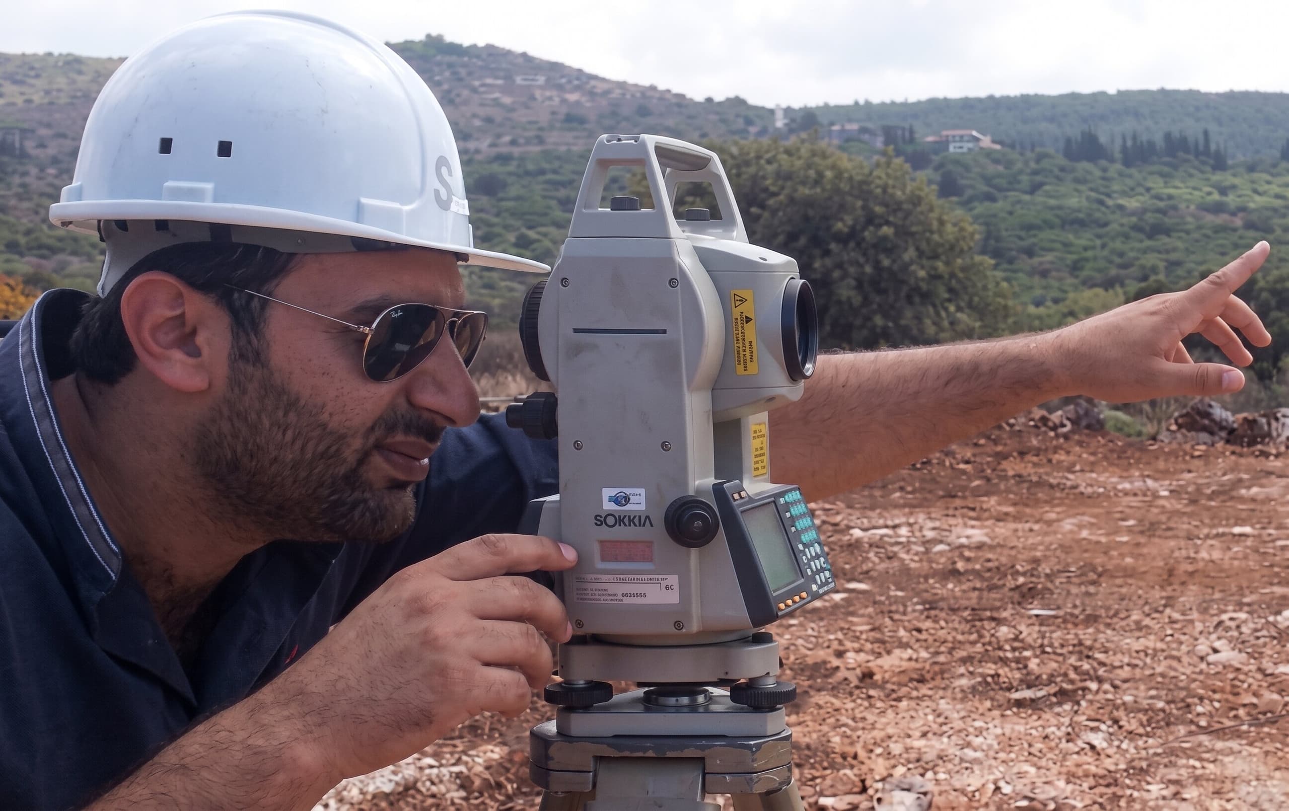
A survey team during fieldwork on a project site

Geodetic and technical capabilities

Equipment and software that we use for lifting, documentation and delivery.

  • Comprehensive monitoring stations

    Measuring angles, distances, and linking ground control points for extended projects.

  • GNSS and RTK devices

    Determining real-time coordinates linked to the Lebanese geodetic network.

  • Aerial surveying by drones

    Covering large areas and producing orthographic images and terrain models.

  • Ground laser scanning

    A dense point cloud of urban sites and existing structures.

  • Geographic Information Systems (GIS) environment

    Building spatial databases and linking the layers to real estate records.

  • Engineering design and delivery

    Producing execution plans, calculating quantities, and matching them with regulations.

Send us the parcel boundaries, and we will return the scope and the schedule.

Every consultation request is reviewed within two working days, with the required field survey, studies and documents defined before any financial commitment.